Day 2 — Land or Water?
Task 1: Map locations
Write a program that takes geographic coordinates (such as 48.95˚N 9.13˚E), and prints out if that point is on land or on water. By convention, North and East are positive numbers.
Familiarize yourself with the data set below.
Make a plan for how you want to approach this task. What sub-tasks need to be done?
Estimate how much time each sub-task will take you before starting.
Make frequent git commits while you work on the solution.
You can work together on the concepts, but everyone should write their own individual copy of code
Landcover data
Helpful data for this task is this data set of global landcover with 1 km resolution (click to download):
Download and then uncompress the data with e.g. bunzip2.
The data originates from http://www.landcover.org/data/landcover/. The University of Maryland Department of Geography generated this global land cover classification collection in 1998. Imagery from the AVHRR satellites acquired between 1981 and 1994 were analyzed to distinguish fourteen land cover classes at a resolution of 1 km [1] .
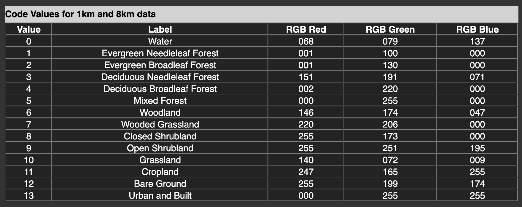
The encoding of the 14 different landcover types is shown here:
To load and handle the data set, Numpy is the perfect tool.
Find out more information about numpy.fromfile or numpy.memmap, they will be useful in your task. What is the difference between them?
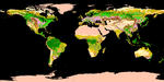
If you like, you can use matplotlib.imshow to visualise the loaded data. This can be a very useful cross-check. Do not plot the full data set, use a subsample by skipping points like this: data[::50,::50]
Task 2: Earthquake list
Decide for each earthquake in the following file if it occurred on land or on water and add that information as an additional semicolon-separated column to the data file:
Task 3: Plot options
Use argparse to add a command line option to your tool that plots the land cover type in a 10°x10° box around the requested position. This option does not need to work with a pipe.
Optional task: User input
Command line
Modify your program to take user input on the command line:
$ ./landcover 48.9 9.13
Land
You can do this either by directly using sys.argv or, better, take a look at the argparse module.
You can make your python script executable like in the example here by a special first line of your script, that tells the Unix kernel which interpreter to use when the file is executed:
#!/usr/bin/env python
Don’t forget to set the x executable permission:
$ chmod ugo+x ./landcover
Unix Pipe
Make your program useable as part of a UNIX pipe on the command line (you’ll need sys.stdin):
$ echo "54.95 -1.67" | ./landcover
Land

$ ./landcover
0.0 0.0
Water
29.93 52.89
Land
[CTRL-D]